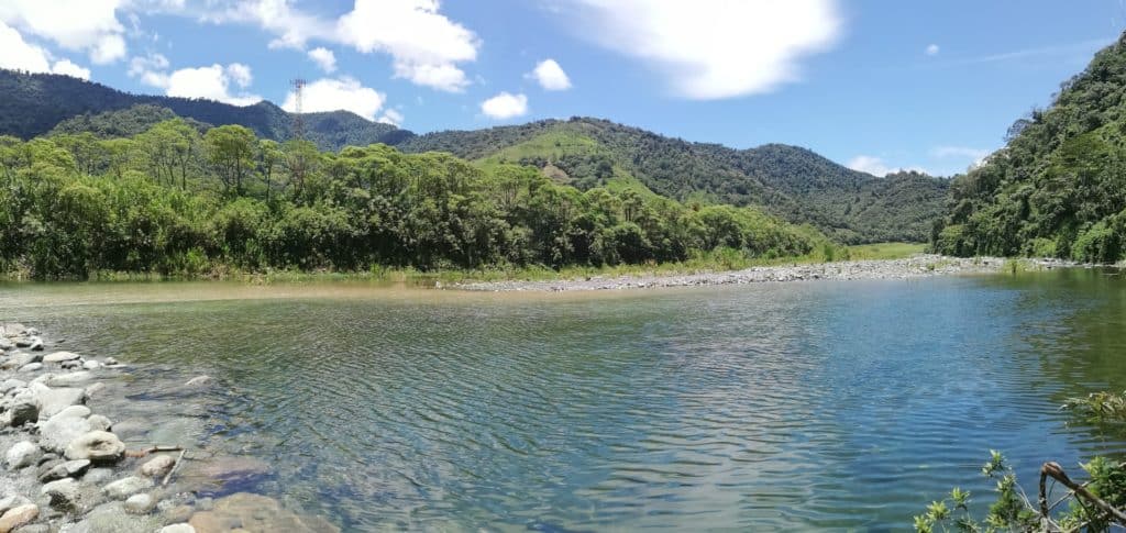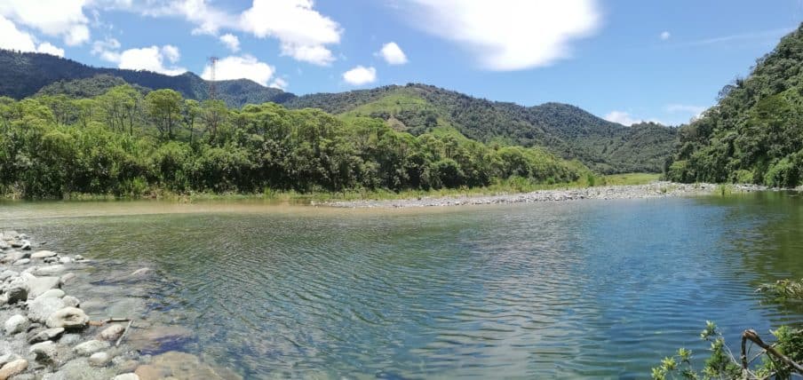
Tapanti National Park in Costa Rica is a stunning natural preserve filled with lush tropical forests, diverse wildlife, and breathtaking scenic trails. Hikers of all levels can explore a range of well-maintained trails, from easy walks along the river to challenging hikes to the summit of the park’s highest peak.
Along the way, you’ll have the opportunity to see an array of flora and fauna, including brightly colored birds, monkeys, and exotic plants. Whether you’re an experienced hiker or just looking for a peaceful walk in nature, Tapanti National Park has something to offer.
One of the highlights of the park is the Rio Grande de Orosi, which runs through the park and is home to a wide variety of fish and other aquatic life.
Visitors can also take a dip in the cool, clear waters of the river or go for a swim in one of the many swimming holes. The park also offers guided rafting trips on the river, which is a great way to take in the natural beauty of the area.
Trails
There are a variety of trails to choose from, ranging from easy, well-maintained paths to more challenging, rugged trails for experienced hikers.
There are 5 main trails at Tapanti National Park in Costa Rica that vary in length and difficulty, giving a range of experiences for hikers of all levels.
- El General: A relatively easy trail that leads to a viewpoint overlooking the Central Valley.
- Los Paraguas: A moderate trail that offers scenic views of the surrounding rainforest and passes by several waterfalls.
- Los Quetzales: A challenging trail that takes you to the park’s highest peak and offers panoramic views of the surrounding landscape.
- Los Coatis: A moderate trail that leads through the heart of the park and provides opportunities to spot wildlife, including coatis and monkeys.
- El Rodeo: A relatively easy trail that follows the river and offers opportunities to see diverse bird species and other wildlife.
These are just a few of the many trails available at Tapanti National Park. Each trail offers a unique perspective on the park’s natural beauty and the diverse ecosystem that calls it home.
Plant and Wildlife
Tapanti National Park in Costa Rica is a biodiversity hot spot, known for its rich plant and wildlife. The park is located in the Central Highlands of Costa Rica and encompasses a variety of habitats, including tropical moist forests, premontane moist forests, and cloud forests. These habitats provide a home for a wide range of plant and animal species.
Some of the notable plant species found in the park include epiphytes, ferns, bromeliads, and orchids, as well as towering trees like the madroño and guarumo.
As for wildlife, Tapanti National Park is home to a variety of species, including monkeys, coatis, squirrels, and a variety of bird species, such as the resplendent quetzal, toucans, and trogons. The park is also home to a number of mammals, such as tapirs, jaguars, and deer, as well as reptiles and amphibians, including poison dart frogs and boa constrictors.
One of the best ways to experience the park is by taking a guided tour. This is a great way to learn about the park’s history, geology, and the many different species of plants and animals that call it home. The park also offers guided bird watching tours, which are a great way to spot some of the park’s many feathered residents.
Culture
In addition to its rich natural beauty, Tapanti National Park in Costa Rica also boasts a rich cultural heritage. The park is located in the Central Highlands of Costa Rica, which has been inhabited by indigenous communities for thousands of years. These communities have a deep connection to the land and its resources, and have developed unique cultural practices and beliefs over time.
One of the most notable cultural heritage sites in the park is the pre-Columbian archaeological site of Guayabo, which is considered one of the most important archaeological sites in Costa Rica. The site includes a network of roads, bridges, aqueducts, and petroglyphs that date back over 3,000 years.
In addition to the archaeological site, the indigenous communities in the area also have a rich tradition of arts and crafts, including pottery, textiles, and wood carving. These traditions have been passed down from generation to generation and continue to be an important part of the local culture.
What to Bring
When visiting Tapanti National Park in Costa Rica, it’s important to pack the right gear to ensure a comfortable and enjoyable experience. Some essential items to bring include:
- Comfortable hiking shoes or boots: The park has a variety of hiking trails, some of which can be quite rugged. Make sure to bring sturdy shoes with good traction to protect your feet and prevent slips and falls.
- Lightweight, waterproof rain gear: Costa Rica is known for its rainy season, so pack a lightweight rain jacket and pants to stay dry during your hike.
- Sun protection: The park’s elevation and thick vegetation can make for sunny conditions, so make sure to pack sunscreen, a wide-brimmed hat, and sunglasses to protect yourself from the sun’s rays.
- Insect repellent: The park is home to a variety of insects, so pack insect repellent to keep them at bay.
- Reusable water bottle: Bring a refillable water bottle to stay hydrated during your hike.
- Personal first aid kit: Pack a small personal first aid kit with band-aids, pain relievers, and any other medications you might need.
- Camera: The park is home to a wide variety of plant and animal life, so don’t forget to bring a camera to capture the beautiful scenery and wildlife.
- Trash bags: It’s important to pack out what you pack in, bring a small trash bag to take any trash with you when leaving the park.
- A sturdy backpack to carry all your items and any extra clothing layers you might need, as temperatures can change throughout the day.
Getting To Tapanti National Park
There are several ways to get to Tapanti National Park in Costa Rica, depending on your location and mode of transportation. Here are a few options:
Car: The park is located in the Orosi Valley, which is a short drive from the city of San Jose. You can rent a car or take a private transportation service to get to the park. The drive takes about 1 hour and 30 minutes from San José.
Public bus: There is a local bus that goes from the city of San José to the town of Orosi, from there you will need to take another bus to the park’s entrance. This option is budget-friendly but can be a bit more complicated than driving.
Tour: If you prefer to have everything organized for you, you can book a guided tour that includes transportation to and from the park. This is a great option for those who are short on time and want a more hassle-free experience.
Once you reach the park, you can park your car in the designated parking area and start exploring the park. It’s important to note that the park’s facilities are limited, and the road can be in poor condition, so it’s important to plan ahead and check the park’s conditions before visiting.
It’s also important to note that the park’s facilities are limited and the road can be in poor condition, so it’s important to plan ahead and check the park’s conditions before visiting. It is recommended to have a car with high clearance or a 4×4 to get to the park, as the road can be bumpy and muddy.
Final Thoughts
Overall, Tapanti National Park is a must-see destination for anyone visiting Costa Rica. The park’s natural beauty, rich cultural heritage, and abundance of plant and animal life make it a unique and unforgettable experience. Whether you’re an experienced hiker, a nature lover, or simply looking for a beautiful place to relax, Tapanti National Park is sure to provide an unforgettable experience.
It’s also a good idea to check the weather forecast before your visit and pack accordingly. And if you’re planning to camp overnight, make sure to bring a tent, sleeping bag, and other camping gear. Remember to be mindful of the park’s limited infrastructure, and to plan ahead and check the park’s conditions before visiting.


